
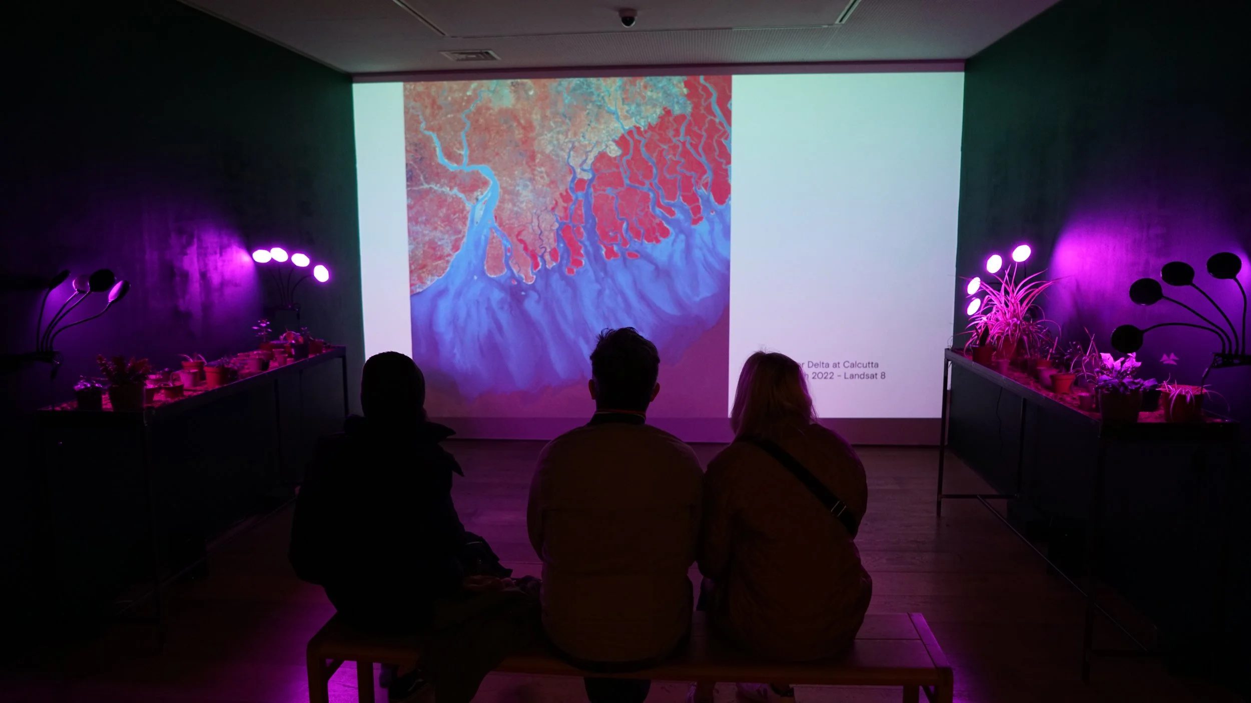
Displayed at Open Eye Gallery as part of the Look Climate Lab 2022.
This collection shows some of the world's great rivers as seen by satellites currently orbiting the planet. Functioning as transitory spaces, the delta or mouth of each river mediates the different planetary forces of freshwater, saltwater, vegetation and human influence. Rendered in the infrared spectrum, these images reveal wavelengths of light hidden to our eyes that allow us to better read these interconnected influences on the planet.
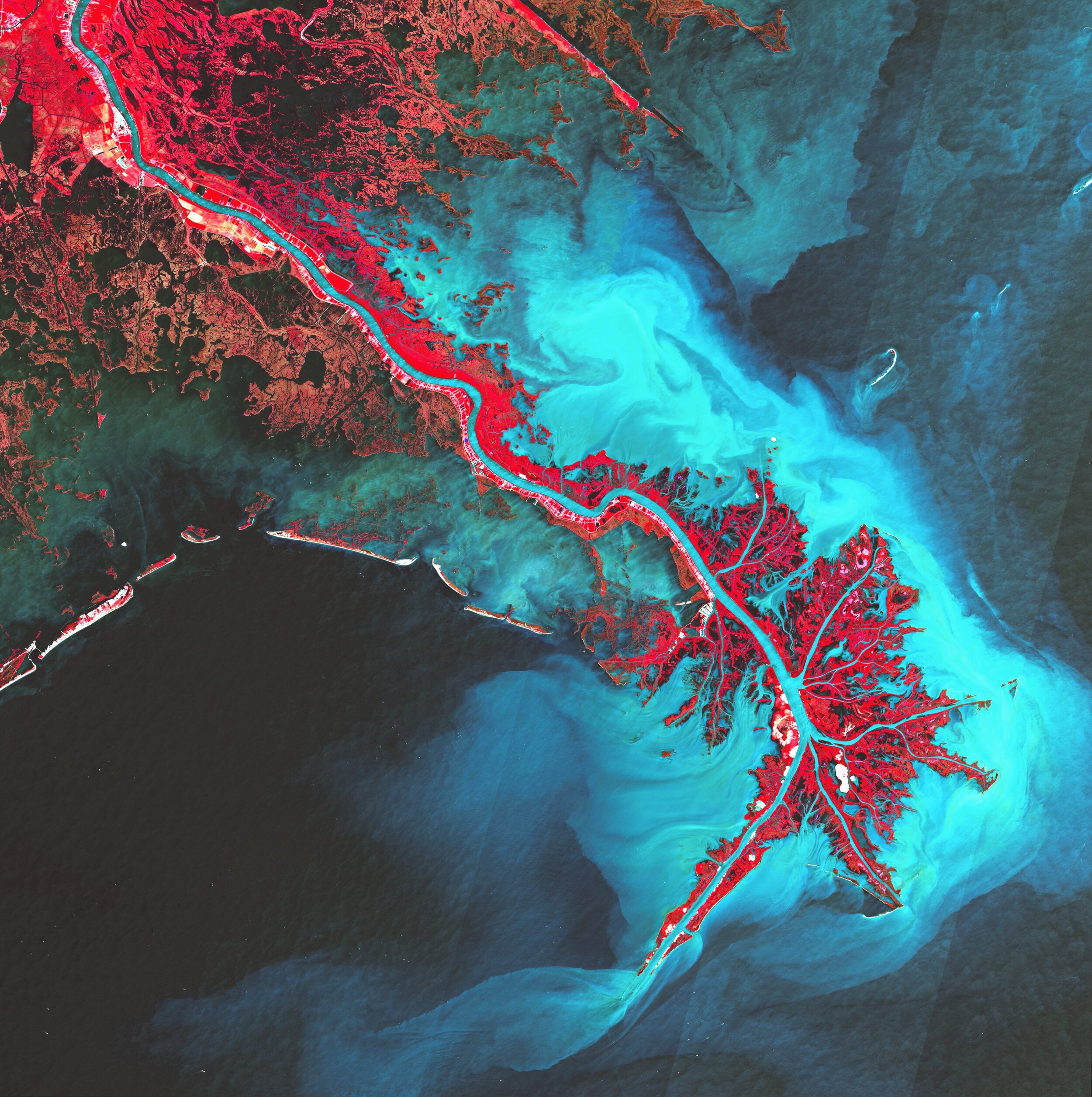
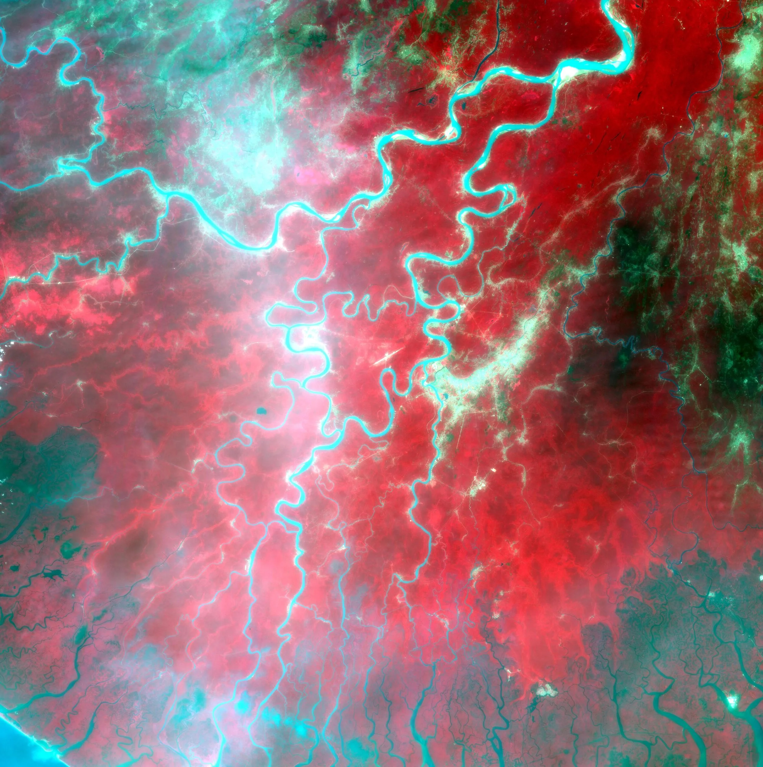
Infrared satellite imagery is tuned to a narrow band of the light spectrum. Since vegetation reflects near infrared and green light, areas of brighter and deeper red suggest faster and denser growing plant life in this order. Areas of black and blue suggest water, with black suggesting clearer water. Urban areas, exposed soils and desert appear in shades of grey to tan.
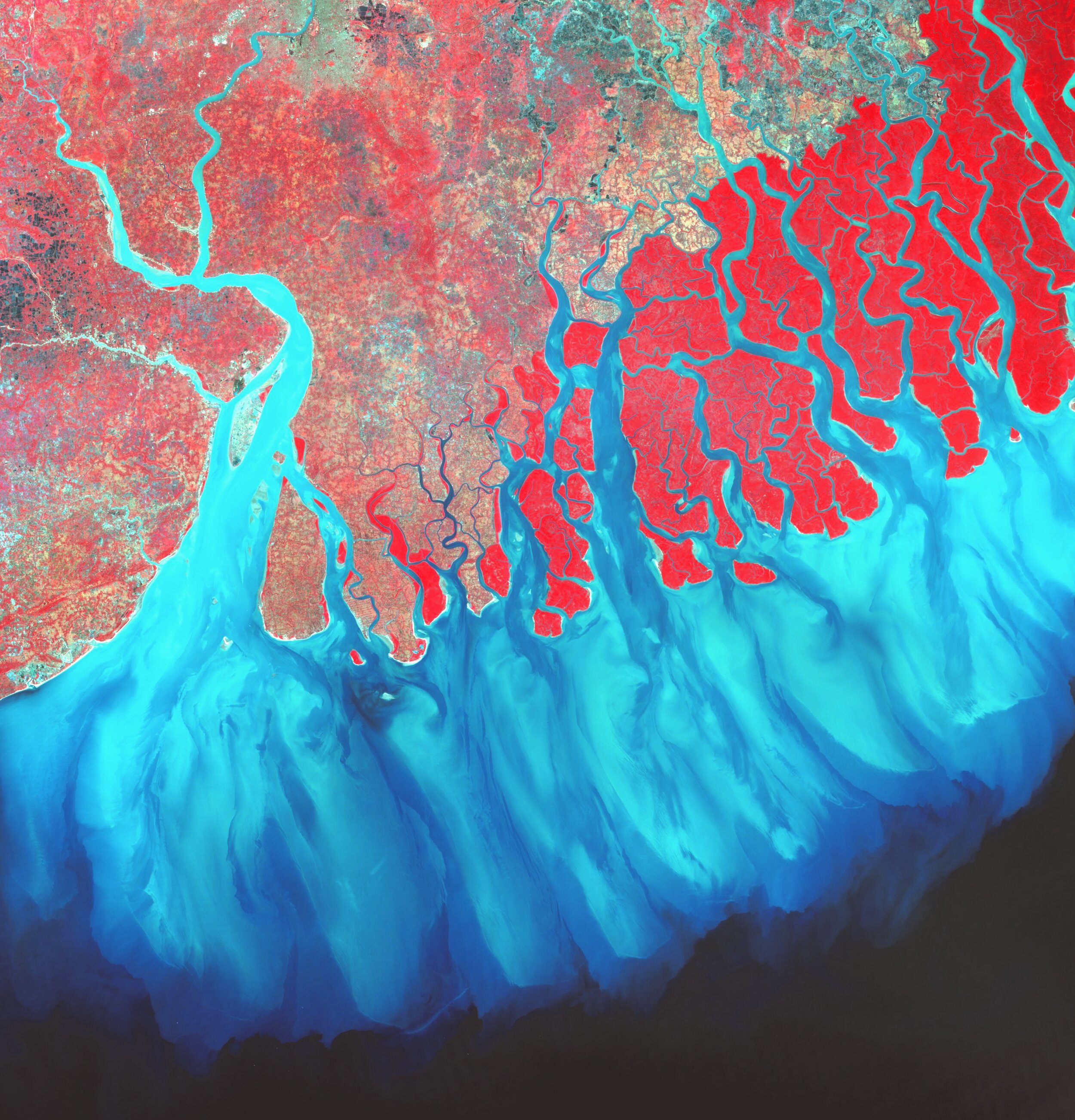
1.Ganges River Delta at Calcutta - February 7th 2022 - Landsat 8

2.Mekong River Delta at Ho Chih Minh - February 23rd 2020 - Landsat 8
3.Mississipi Delta - May 7th 2020 - Sentinel 2

4.Mouth of the Euphrates at Kuwait City - October 31st 2021 - Landsat 8

5.Mouth of the Amazon - October 12th 2021 - CBERS 4

6.Mouth of the Yangtze River at Shanghai - April 29th 2021 - Landsat 8

7.Mouth of the Yukon River - May 25th 2021 - Landsat 8
8.Niger Delta Floodplain - December 10th 2021 - Landsat 8

9.Nile Delta at Cairo - January 13th 2022 - Sentinel 2